
Cambridge Street Directory Workflow
A Cambridge street directory search works best as a short chain, not as one broad name search. Begin with the address in the Cambridge Property Database. It is designed for a street number, street name, and unit, then leads into assessment details and parcel identifiers. From there, use the map to place the parcel among the nearby lots. A land-record result can establish a recorded interest, while a historical directory or poll list can add dated address evidence. Each source should keep its own label rather than being converted into a claim about a whole household.
- Enter the street number, street name, and unit when applicable in the Cambridge assessor search. Save the location, parcel details, and the retrieval date.
- Open the same place in Cambridge GIS or myCambridge. Check the mapped parcel, Map/Lot context, nearby parcels, and any historic or civic layers that fit the question.
- Use the parcel or address in the Middlesex South Registry of Deeds property search. Read the recorded instrument and its legal description before following a party name.
- For a candidate voter record, use the Cambridge Voter Registration Search handoff with the person’s name, date of birth, and residential ZIP. It confirms a single registration result, not a street roster.
- For an earlier address period, compare a reverse directory, poll list, permit record, or newspaper item with the edition date and the address as printed.
That order preserves a useful distinction: a tax or deed party may be an owner, while a directory entry or civic record may be a dated address association. Neither result alone proves who was present at a property on a particular day.
Cambridge Street Address Fields
The Cambridge assessor search is address and parcel oriented. Its visible fields make it practical for a known street, a numbered building, or a condominium unit. It does not expose an inspected owner-name field, so a street directory search that begins with only a name should not assume the property database can answer it. Use the Registry name modes or historical collections for that direction of travel. The Property Database also has advanced controls that can narrow a group of similar parcels without turning the result into a resident list.
| Cambridge Property Field | Input | Use for Street Research | Important Limit |
|---|---|---|---|
| Street Number | Optional text | Targets a numbered property. | Use the city’s normalized address form. |
| Street Name | Optional text | Finds the address or a street sequence. | Not an owner-name field. |
| Unit Number | Optional text | Separates a unit from a larger building. | Compare it with the parent building. |
| Map / Lot / Unit | Optional text | Links assessment, GIS, and Registry work. | Use the displayed city format. |
| Sale date or price | Optional ranges | Helps isolate a recorded transfer period. | Assessment updates and recording dates can differ. |
| Class, style, district | Optional menus | Reduces results among like parcels. | These describe property administration. |
Record the field label exactly when reviewing a result. A location or situs field identifies the physical parcel. A mailing field identifies where tax correspondence goes, which may be a representative, trust, business, or address outside Cambridge. That difference is central to responsible street research.
- Parcel
- A unit of property used to connect assessment and map information. In Cambridge, Map, Lot, and sometimes Unit components identify that link.
- Situs address
- The physical location of the parcel or building. It is the address used for assessing, permits, and many GIS records.
- Plat or plan
- A recorded map or plan that helps define a parcel. The Registry instrument and Land Court plan carry more authority than a map display.
- Criss-cross directory
- A reverse directory arranged from address to a listed person or business, rather than from name to address.
Cambridge Street GIS Context
Cambridge GIS supplies the spatial part of a street directory check. AxisGIS offers property, utility, land-use, and historic themes, along with query, select, export, measure, map-markup, and abutters-list tools. myCambridge centers its search on an address and can return assessing, historic, neighborhood, voting, ZIP, Census, and nearby-place panels. The map is especially useful when a street has dense parcels, units, or nearby cross streets that make a text result ambiguous.
Cambridge GIS presents the AxisGIS property theme used to move from a mapped parcel toward assessment information.
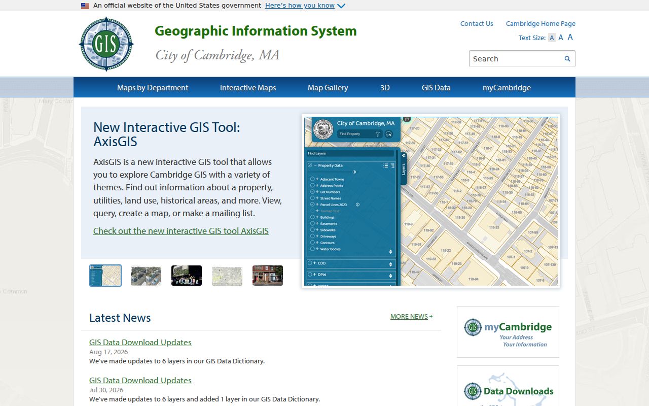
The image shows why the map should be treated as context. Cambridge’s FY2026 parcel layer supports visual reference, address matching, and geocoding, but the City says it is not the authority for land area or tax calculations. Deeds and Land Court plans remain the controlling sources for legal boundaries.
The VisionMap parcel-map index divides the city into 286 blocks and caps a query or selection at 2,000 records. For a street segment, click one parcel at a time or log a small set of adjacent parcels. A polygon can represent a lot, a building, or a condominium arrangement, so a visible shape is not a complete statement about a household.
Note: Save the visible layers, map date, scale, and Map/Lot value when a GIS view is used to support a Cambridge address finding.
Cambridge Street Deed Trail
The Middlesex South Registry of Deeds is the title-record source for Cambridge. Its online search supports Recorded Land, Registered Land, plans, names, documents, books, property, dates, certificates, and unindexed property modes. A property search can lead from a street address to an instrument, but the legal description, plan reference, unit, book and page, or document number must be compared before treating two records as the same property.
Massachusetts Land Records shows the Middlesex South interface with Recorded and Registered Land search modes and party, town, document-type, and date controls.
Use Cambridge as the town filter where appropriate, then read the instrument rather than relying on a snippet. A grantor is a party transferring an interest. A grantee is the party receiving it. Mortgages, releases, liens, discharges, corrections, and deeds should not be treated as the same event.
Online viewing, printing, and downloading of recorded documents are stated as free by the Registry. Its certified-copy page lists $1 per page for a deed or document and $5 for a registered-land certificate. Mail requests use the Registry’s Cambridge Street address and require the cited instrument details, payment, and a stamped return envelope.
Cambridge Street Records Compared
Several Cambridge records can be keyed to an address, but they answer different questions. The assessment result supplies current parcel context. GIS locates the parcel and nearby geography. The Registry documents recorded title activity. Permit and Historical Commission material can date work on a structure. Voter information has a much narrower confirmation or request-based path. Combining the sources is useful only when every record’s date, keeper, and relationship label stay visible.
| Address Record | Cambridge Keeper | What It Can Show | Access Route |
|---|---|---|---|
| Assessment database | Cambridge Assessing | Situs, parcel, class, value, sale, size, and property details. | Free address and advanced search. |
| GIS parcel layer | Cambridge GIS | Map/Lot, geometry, blocks, adjacency, and civic layers. | Public map and REST layers. |
| Recorded land | Middlesex South Registry | Parties, conveyances, legal descriptions, plans, and citations. | Online index and images; certified copies have stated fees. |
| Permits and House Books | ISD and Historical Commission | Project, work, owner-surname, building, or foundation clues. | Permit Finder, CHC collections, or a focused request. |
| Voter information | Election Commission and state | A candidate’s registration status or lawful file fields. | Name, date of birth, and ZIP confirmation; request rules apply. |
The Massachusetts state voter lookup is not a free all-address tool. It requires a name, date of birth, and residential ZIP, then returns registration or pre-registration status, active or inactive status, polling location, and elected officials. A municipal file has a different access context and may contain fields subject to eligibility, licensing, and confidentiality limits.
Cambridge Street Permit Evidence
Permit evidence adds a building timeline to a street directory project. Cambridge’s April 2026 Permit Finder announcement describes an address search, permit-type filters, a map, multiple layers, and click-through permit details across more than 30 permit types. The announcement does not establish a complete live field schema, date range, or universal person field. Treat a permit as evidence of a project, application, inspection, or change in use, then preserve the label shown in the record.
Older street work has a different route. The Cambridge Historical Commission’s permit index covers 1886 through 1937 and is keyed by owner surname. House Books spanning 1875 through 1932 can supply surveyed foundation plans and measurements. Ask the Historical Commission to check a specific address, suspected older forms, Map/Lot information, and a date range rather than asking for a generalized ownership list.
When an online result is missing, a focused Cambridge public-records request can name the address, case number if known, date range, record type, and the public fields sought. The City’s Public Records Access Officer accepts portal, email, mail, fax, and in-person requests under the Massachusetts Public Records Law. Initial responses are generally due within 10 business days, while exemptions, redactions, fees, or extensions can affect what is supplied.
Cambridge Street Registry Index
Cambridge’s street directory evidence gets stronger when the address is linked to the correct Registry instrument. The Registry announced in October 2025 that grantor indices for 1896 through 1973 were added online. That expansion is a useful bridge into older title research, but it is not a universal start date for every document image or index series. When a normal property search misses a result, try the recorded or registered land mode that fits the record, then use unindexed property, a plan, a certificate, book and page, or office research as needed.
The Middlesex South Registry describes the online availability of the historic grantor-index expansion and Registry copy options.
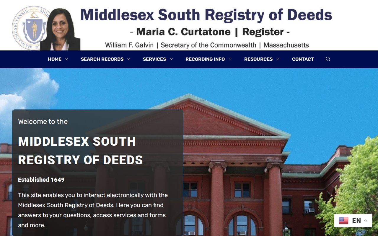
The index is a starting point, not a title opinion. Read the legal description and watch for a condominium unit, parcel split, plan, correction, mortgage release, or registered-land reference. Those details can explain why a familiar street address seems to disappear from a simple search.
Cambridge Historic Street Sources
For an earlier Cambridge address, reverse directories are the key address-to-person source, particularly in later editions from about 1905 onward. They should be read alongside the edition year, abbreviations, and the neighboring entries. Historical poll lists from 1904 and 1932 through 1947 can add a civic snapshot. The Cambridge Public Library and Historical Commission also hold directories, maps, newspapers, permits, photographs, and address-history resources.
Cambridge’s directory run is near-continuous from 1846 or 1848 through 1972, depending on the edition and repository. A record in one directory means the publisher associated the entry with that address at that time. It is not a substitute for a complete household list. For the collection years, entry conventions, and a longer household-tracing method, consult the Cambridge city directory collections.
Historic maps help resolve a street extension, old village label, changed number, or name variation. Compare the block, cross street, parcel description, and nearby names across sources. Official Cambridge materials reviewed for this project do not give one dated citywide renumbering table, so a specific renumbering year should not be assumed.
Cambridge Street Address Continuity
Cambridge has kept records through a long municipal history. City sources place its founding in 1630, first street-grid work in 1631, adoption of the Cambridge name in 1638, and city incorporation in 1846. The City Clerk reports legislative records reaching to 1630 and vital-statistics collections reaching into the early 1800s. That continuity helps, but records from different eras can use different street forms and live with different custodians.
A June 2026 City Clerk announcement described a new online viewing platform with more than 85,000 historical City records after four years of digitization. It is an additional viewing layer, not a merger of library, Historical Commission, Registry, and court custody. Keep the collection name, source date, and original keeper with each street result.
Note: A Cambridge deed, directory, map, and voter item can describe the same place differently, so compare location details before joining them.
Cambridge Street Voter File Limits
A Cambridge street directory cannot turn the ordinary state voter confirmation into a by-street roster. The public lookup requires a candidate’s name, date of birth, and residential ZIP, then returns limited registration information. Broader voter-file fields have a different request and use context. The Secretary of the Commonwealth describes some public fields, but phone, email, veteran status, permanent-absentee status, confidential voter information, and minors’ information are not public in ordinary voter files.
For historical work, Cambridge poll lists from 1904 and 1932 through 1947 are dated civic snapshots. Transcribe the list year, ward or precinct, street, house number, and printed name before comparing it with a directory edition. A poll list can differ from a household listing without creating a contradiction. It records an eligible voter in that period, not every person who lived at the address.
Cambridge Street Directory Limits
A Cambridge street directory search cannot establish every person connected with a building. Recorded land can show a party to a conveyance, and an assessment record may show tax-related fields. Neither necessarily proves current presence. A voter confirmation is limited to one candidate record, while a full file has restrictions. Public utility customer data and motor-vehicle address data are not ordinary street-search sources. Confidential voter information, minors’ information, and Address Confidentiality Program participants must not be inferred from other records.
Lawful use. Cambridge address records support personal, civic, and family-history research. Do not use them to stalk, harass, threaten, impersonate, or harm anyone.
Massachusetts law protects confidential addresses and restricts some records. The Massachusetts Address Confidentiality Program provides a substitute address for qualifying participants, and it is not appropriate to use maps, deeds, voter information, or old directories to work around that protection. A missing field can be a legal safeguard, not a research error.